Drones & Photogrammetry
I transform your concepts into visual reality, delivering photorealistic renderings and immersive animations that capture attention and set your project apart.
Drone Flight Mission
Every aerial survey begins with meticulous flight planning. This includes defining the flight path, altitude, overlap settings, and ground control points to ensure optimal coverage and data accuracy.
Data Capturing
Using high-resolution drone cameras, images and videos are captured over the target area. The collected data is geotagged and consistent, forming the raw input for precise 3D reconstruction.
Photogrammetry Processing
Captured images are processed using photogrammetry software to generate outputs like orthomosaics, point clouds, and 3D models. This step enables:
Construction Site Mapping for tracking progress and measurements
Agricultural Land Survey for crop health and land analysis
Urban 3D Modeling for planning and visualization in infrastructure projects
Surat Railway Station
Conducted a detailed drone-based aerial survey of the land surrounding the railway tracks at Surat Railway Station. The objective was to assist in planning a solid compound wall along the track boundaries. Processed the collected data to generate high-accuracy DSM (Digital Surface Model) and DTM (Digital Terrain Model), and provided precise measurements for the total compound length required by the railway authorities.
Project Duration: 30 days
May 2022
Construction Site Gaussian splatting
I implemented Gaussian Splatting on a construction site to create a high-fidelity 3D visualization for progress tracking. This innovative method allowed real-time walkthroughs and clear presentations for client authorities, making it a promising tool for future project monitoring and reporting.
Client: Private client
Project Duration: 3 days
April 2025
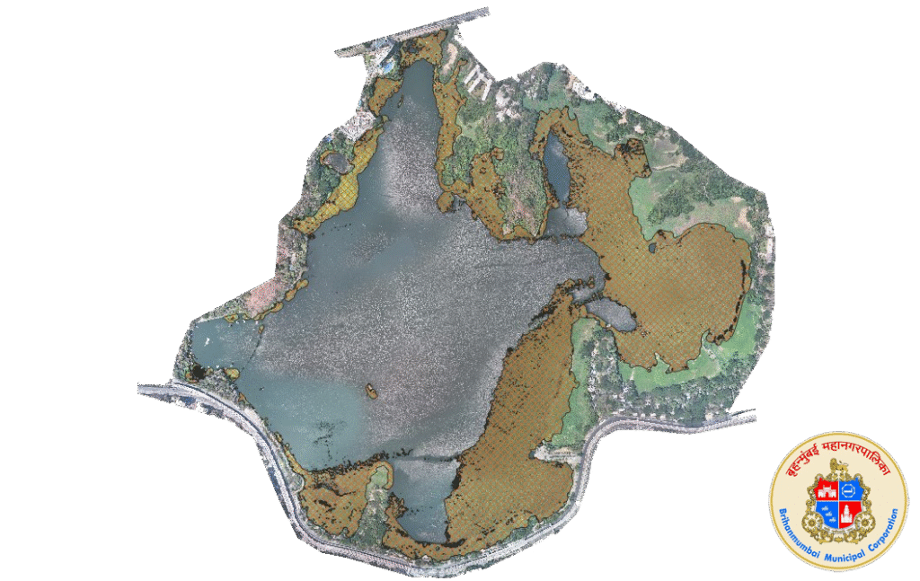
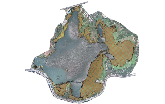
Powai Lake Algae Area Calculation (BMC)
I worked on the Powai Lake Algae Area Calculation project for BMC (Brihanmumbai Municipal Corporation), Mumbai’s municipal authority. This challenging agricultural survey involved measuring the area covered by unwanted algae growth on the lake surface. Due to the constant movement of algae on the water, careful flight planning and scanning were complex and required precision. Processing the data to accurately calculate the algae-covered area was also difficult. Using QGIS software, I successfully analyzed the data and delivered precise measurements of the affected zones, supporting BMC’s efforts to monitor and manage the lake’s ecological health.
Client: Brihanmumbai Municipal Corporation
Project Duration: 15 days
February 2025
Shall we discuss?
Have a project or idea? Feel free to reach out.
Let’s create something amazing together.